Today, the Meteorological Department has issued a rain alert in 8 districts of Haryana. These include Gurugram, Mahendragarh, Charkhi Dadri, Bhiwani, Rewari, Jhajjar, Rohtak, Hisar. Most of the districts are cloudy. People got relief from the heat after morning rain in Jind and Bawanikheda of Bhiwani. Apart from this, there was light drizzle in Barwala.
There is a heatwave alert in 13 districts of Punjab for the second consecutive day. These include Gurdaspur, Amritsar, Tarn Taran, Ferozepur, Faridkot, Muktsar, Fazilka, Moga, Bathinda, Barnala, Mansa, Ludhiana and Sangrur. There will be a drop in temperature from tomorrow, June 27.
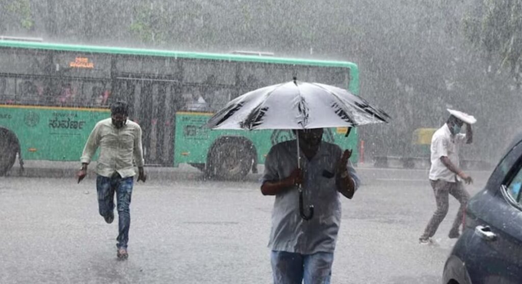
Due to the rain and strong winds in the past few days, the average temperature of Haryana has dropped by 1.4 degrees, while the average temperature of Punjab has dropped by 0.7 degrees. No change has been seen in Chandigarh. At the same time, it is raining continuously in the middle and upper areas of Himachal.
Chances of rain in Punjab, Haryana and Chandigarh
In Punjab, there is a possibility of scattered rain till June 27, some on June 28-29 and moderate rain in most districts on June 30-July 1. In Haryana, there is a possibility of scattered rain today, at some places on June 27, many on June 28-29 and light to moderate rain at most places on June 30 and July 1. Chandigarh may experience strong winds and rain with thunder from June 27 to 29.
Rain in middle and upper areas of Himachal even today
In Himachal, Kasauli 58.6, Paonta Sahib 42.0, Nahan 34.2, Dharampur 27.4, Nahan AWS 25.5, Pachhad 24.0, Mandi 15.8, Sundarnagar 15.2, Arki 15.0, Katola 14.4, Manali 10.0, Renuka/Dadhou 9.2, Solan 6.2, Gohar 5.0, Shimla Aero 5.0, Jogindernagar 4.0, Pandoh 4.0, Kandaghat 4.0 MM rain has been recorded.
At the same time, rain is expected in middle and upper areas even today. While the weather may remain dry in the lower areas.
Monsoon situation in the country
The southwest monsoon has advanced into some more parts of the North Arabian Sea, Gujarat state and Madhya Pradesh and some parts of south-east Rajasthan.
Conditions are favourable for further advance of southwest monsoon into remaining parts of north Arabian Sea, Gujarat state, Madhya Pradesh, some more parts of Rajasthan, remaining parts of Chhattisgarh, West Bengal, Jharkhand and Bihar.
Monsoon may advance into some parts of Uttar Pradesh, Uttarakhand, Himachal Pradesh, Jammu & Kashmir-Ladakh-Gilgit-Baltistan-Muzaffarabad, northern parts of Punjab and northern parts of Haryana by 30th June during next 3-4 days.

